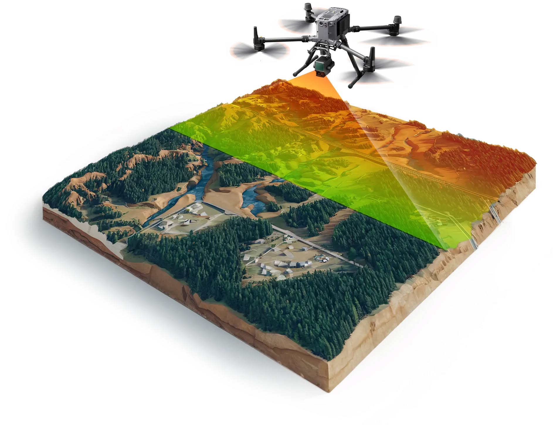
LiDAR mapping
Lidar drone mapping is an innovative remote sensing method that uses laser pulses to create highly accurate 3D models of the earth's surface and the objects on it. By integrating advanced sensors and precise navigation systems (RTK/PPK), the technology allows for the generation of dense point clouds and digital models even in the presence of dense vegetation or complex terrain.
Precise 3D scanning
The service is carried out using specialized drones equipped with high-end LiDAR sensors that emit hundreds of thousands of laser pulses per second. This technology provides direct and precise measurements of distances to objects, guaranteeing georeferenced accuracy at the centimeter level. The collected data is processed with specialized software to obtain realistic and measurable digital copies of reality.
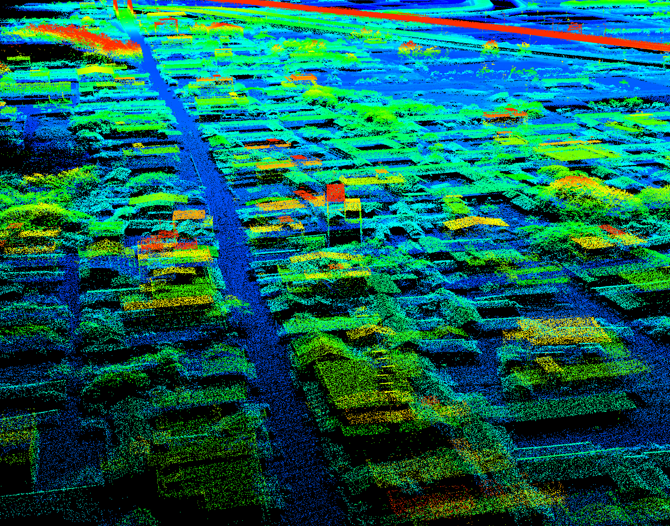
Point Clouds
Georeferenced high-density 3D point clouds that recreate the exact shape, structure, and coordinates of the captured objects and terrains. They are suitable for complex engineering and architectural analyses, providing unparalleled detail.
Digital terrain models (DTM and DSM)
High-precision models that show the actual ground surface (DTM) by filtering out vegetation and buildings, as well as models including all above-ground objects (DSM). They are ideal for hydrological analysis, geodesy, and design.
Geodesy and complex infrastructure
The application of LiDAR technology is indispensable when surveying objects with complex topography, dense vegetation, or linear infrastructure such as power lines and roads. High-precision laser data allows for effective planning, safe inspection of hard-to-reach areas, and detailed control over large-scale projects of any type.
Vegetation penetration
Lidar sensors have the ability to reflect multiple signals from a single pulse, allowing them to pass through tree canopies and reach the actual terrain. This greatly facilitates the creation of accurate topographic maps in forested and overgrown areas.
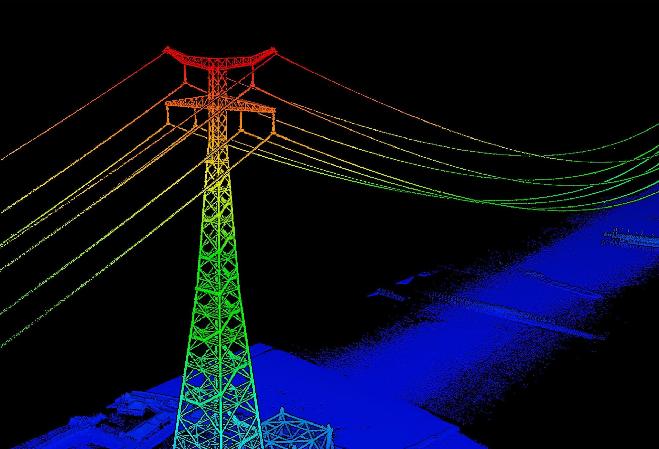
Power lines inspection
The technology captures thin and complex structures such as cables and poles with incredible detail. The resulting data supports the analysis of conductor sag and the accurate assessment of the risk of contact with surrounding vegetation.
Technical applications

Generation of high-precision digital terrain models (DTM)
Mapping of densely forested and hard-to-reach territories
Design and monitoring of linear infrastructure (roads, railways)
Power line inspection and vegetation encroachment analysis
Earthwork volume calculations (cut/fill) with the highest degree of accuracy
Creation of architectural and structural 3D models
Geodetic surveys for the purposes of cadastre and spatial planning
Landslide risk analysis and soil erosion assessment
Hydrological modeling and water resource management
Integration into BIM (Building Information Modeling) systems
Benefits compared to classical photogrammetry and terrestrial methods
Drone LiDAR scanning offers unique advantages over traditional photogrammetry and classical geodetic surveys. Its nature as an active sensor and the ability to directly collect 3D data make it the preferred choice for specific and complex missions:

Vegetation penetration: Unlike photogrammetry, which only "sees" the surface, LiDAR pulses reach the ground even through dense forests, allowing for the creation of an accurate digital terrain model (DTM).
Operation in low-light conditions: Since LiDAR is an active sensor that emits its own light (laser pulses), it does not depend on sunlight and can operate effectively in cloudy weather or low-light conditions.
Direct 3D data collection: The technology directly measures the distance to objects, eliminating the need for complex software algorithms for image matching. This significantly accelerates the data processing workflow.
Capturing fine structures: LiDAR systems are extremely effective at surveying thin objects without clear texture, such as power lines, wire fences, and complex metal structures, which are often problematic to capture using standard cameras.