Our services
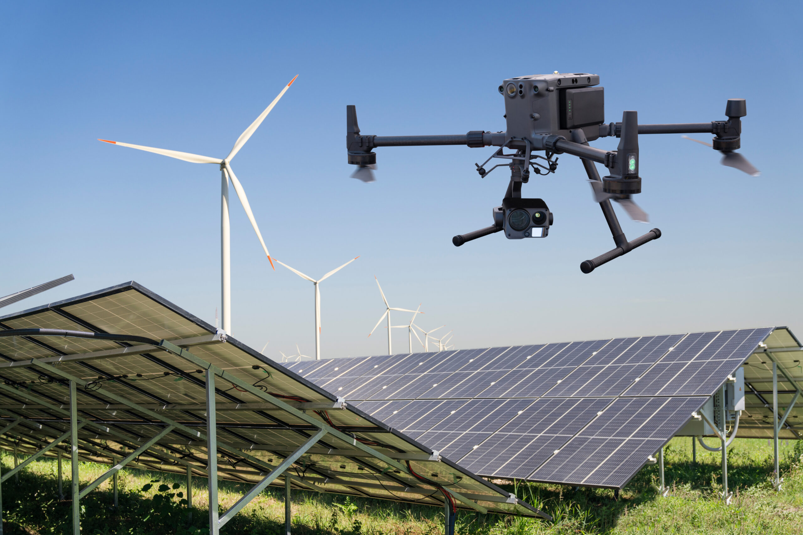
Welcome to the world of professional drone services! Explore our offerings and find out
how we can help you with accuracy, efficiency, and innovative technologies.
Solar inspection
Drone inspection of solar panels involves thermal and visual checks, combined with analysis of the collected data. This service provides a reliable and precise way to identify defects, offering a detailed view of the panels' condition. This contributes to timely maintenance and the extension of their operational life.
See more
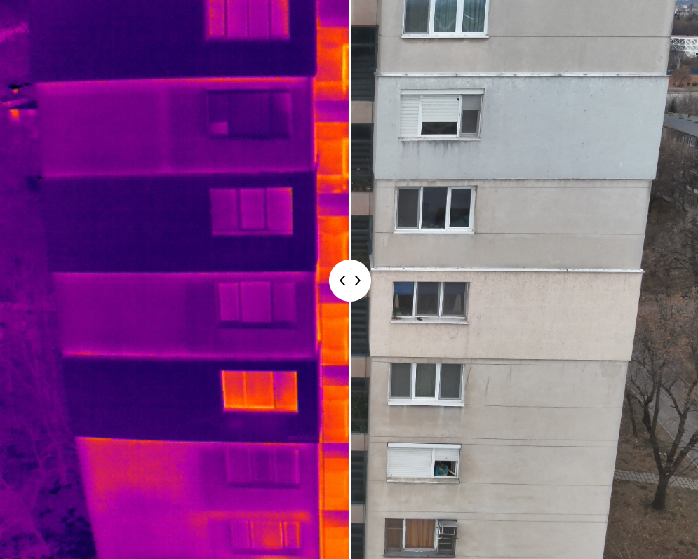
Building inspection
Building inspection covers thermal and visual inspection of facades and roofs, providing a comprehensive analysis of their condition. The thermal check detects heat loss, hidden leaks, and insulation problems, while the visual inspection identifies physical damage, material wear, and other defects.
See more
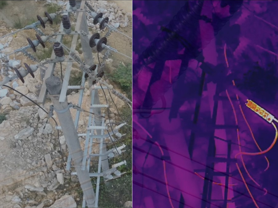
Power lines inspection
Drone inspection of power lines includes visual and thermographic checks, providing a safe and fast way to detect damage, wear, and thermal anomalies. This innovative technology allows for the efficient inspection of hard to reach sections, minimizing risk and optimizing maintenance processes.
See more
Wind turbine inspection
Drone inspection of wind turbines includes visual and thermographic checks, providing a safe and reliable way to examine the blades, rotor, and other components. This approach allows for the detection of defects such as cracks, erosion, and thermal anomalies, which contributes to timely maintenance and the extension of their operational life.
See more

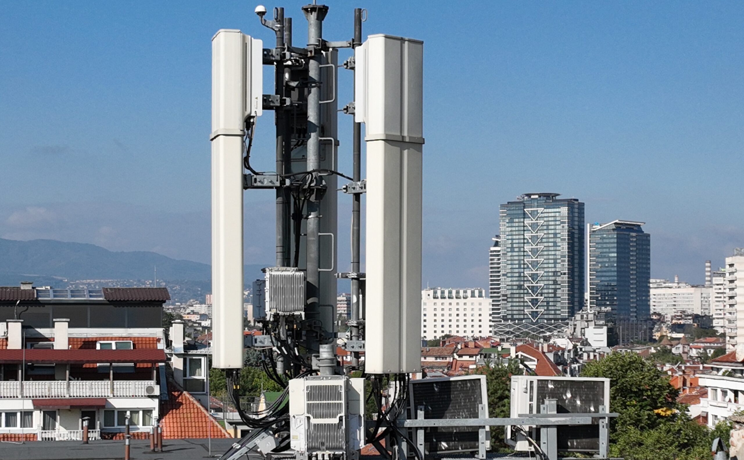
Cell tower inspection
Drones provide a safe, fast, and detailed way to inspect cell towers without the need for climbing. Through high resolution visual and thermal imaging, defects, overheating, and structural problems are detected, and a 3D model is created for full visualization and a reliable basis for analysis, maintenance, and long-term infrastructure efficiency.
See more
Search and rescue
Drones equipped with thermal cameras assist rescue teams, institutions, and private individuals during emergencies by quickly and safely locating people or animals in hard to reach areas. Thanks to the aerial perspective and the detection of thermal signatures, the service ensures a timely response during disasters, accidents, and search operations, combining modern technology with professional planning for maximum efficiency and safety.
Вижте още
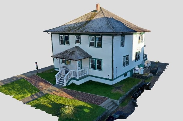
Drone photogrammetry
Drone photogrammetry provides precise and detailed reproduction of terrains, infrastructure, and objects using industrial aerial platforms. By utilizing modern aerial imaging and photogrammetric processing technologies, highly accurate geospatial models are created, applicable in various professional projects.
See more
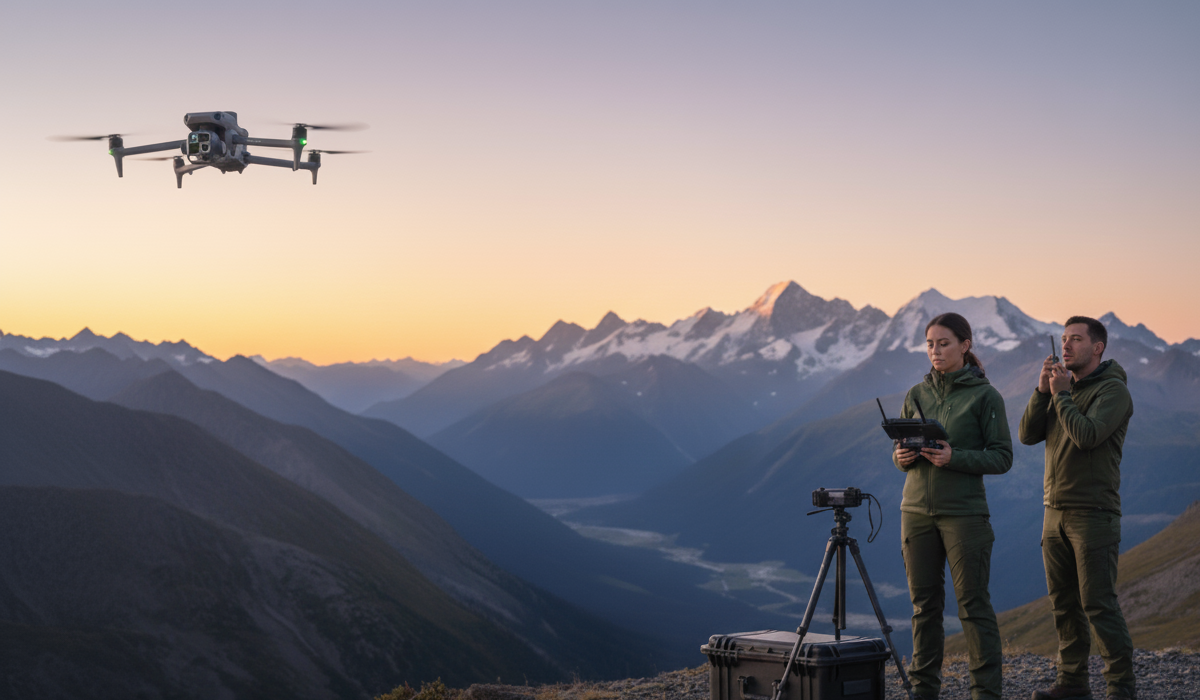
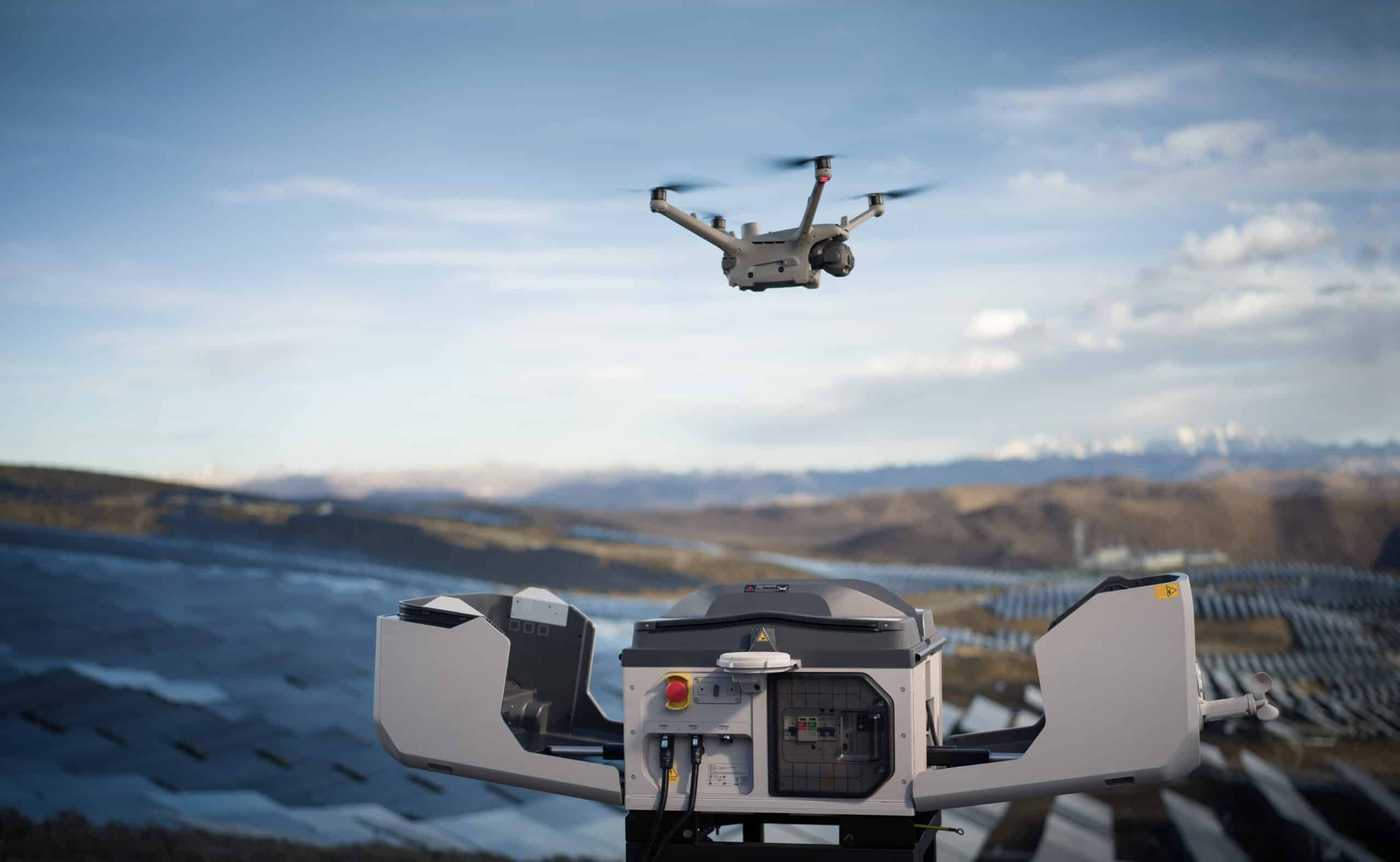
Аutonomous drone systems
Autonomous drone stations enable the use of latest-generation industrial drones 24/7 without the need for an on-site pilot. This ensures continuous data collection, inspections, control, and enhanced security even at remote and hard-to-reach sites. By implementing intelligent solutions, businesses achieve constant operational readiness and an effective tool for automated monitoring and management.
Вижте още
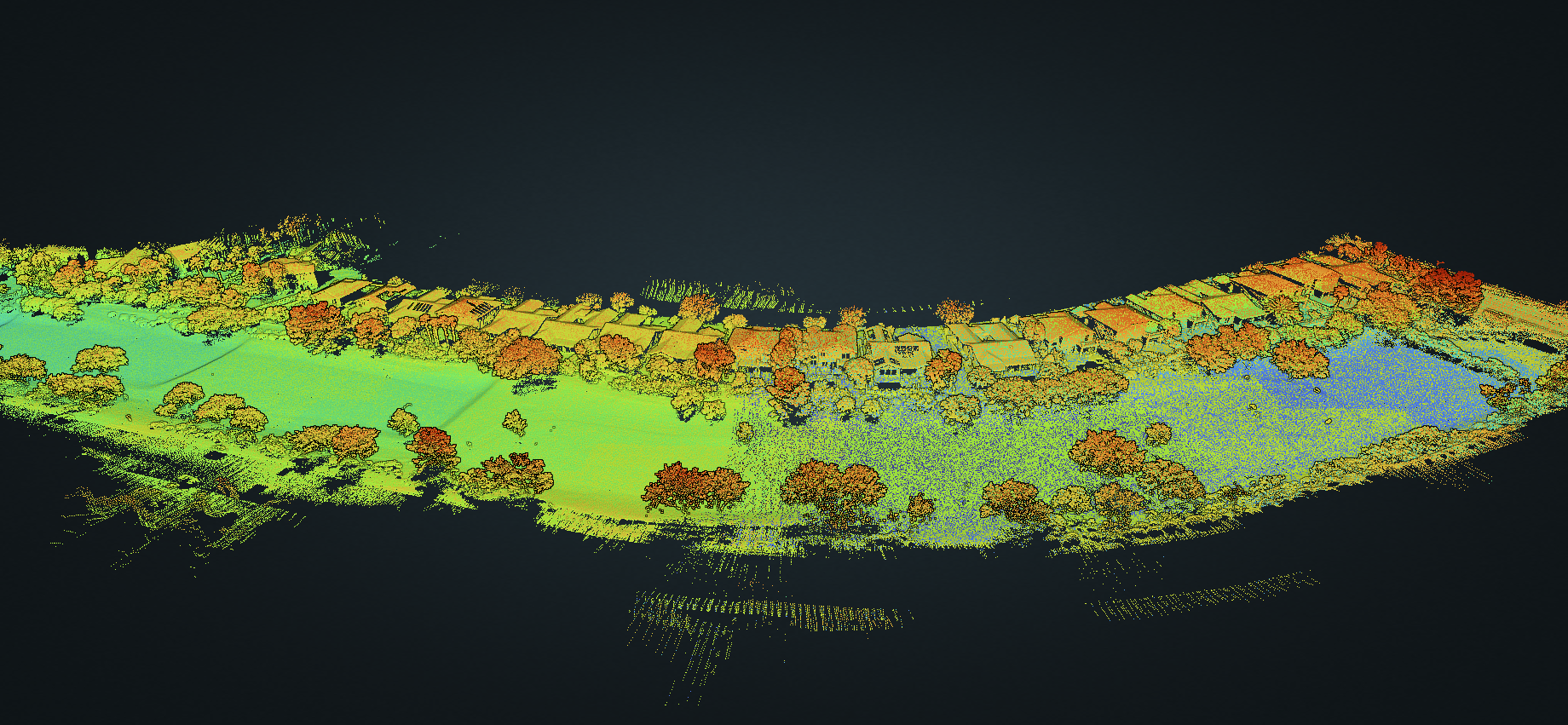
LiDAR mapping
Lidar drone mapping is an innovative remote sensing method that uses laser pulses to create highly accurate 3D models of the earth's surface and the objects on it. By integrating advanced sensors and precise navigation systems (RTK/PPK), the technology allows for the generation of dense point clouds and digital models even in the presence of dense vegetation or complex terrain.
Вижте още